Sunday, February 10, 2013

Rocky Face Mountain Recreational Area in Alexander County, NC

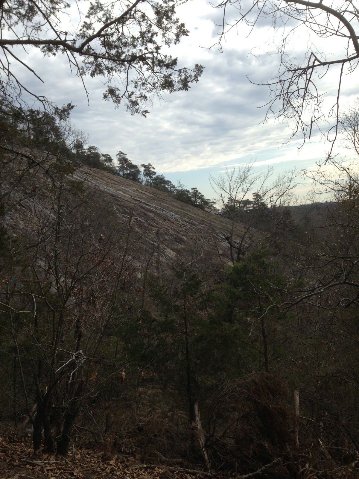
This former rock quarry and the 318 acres surrounding the dome shape mass of granite gneiss and the sheer cliff face was put on the North Carolina Registry of Natural Heritage Areas in 2007. Rocky Face Recreational Area offers great climbing access, 4 miles of hiking trails, picnic shelter, restrooms, and staff on site. Climbing is by permit only. Currently there are three trails; Hollow Rock Trail (2.5 miles), Grindstone Trail (1 mile), and Buzzard Roost Loop (8/10 miles). Another trail is under construction. The staff would come out and greet you, very friendly and helpful. I started up the rock staircase of Buzzard Roost Trail, half of which follows along a slab of granite up 100 ft to the overlook. At the overlook the Buzzard Roost Trail connects to the Hollow Rock Trail. With many switchbacks the Hollow Rock Trail goes up about 600 ft and loops around two summits. The Hollow Rock Trail passes a series of rock overlooks. I then hiked back down by the Grindstone Trail, more switchbacks. The Grindstone Trail follows a trickle of water down the mountain to a steady creek and back to the base of the rock face. Toward the bottom of the Grindstone Trail the forest is littered with fallen tree trunks. All the trails are well marked and moderate to strenuous hikes. If you want a quick getaway for a day hike, only an hour from Charlotte, then I suggest Rocky Face Recreational Area.

Hike: 4 miles

Rocky Face Mountain

Rocky Face

Rock Staircase

Hollow Rock Trail

Great Mullein

Blue-eyed Grass or Star Grass

Ass of a Tree

Overlook on Buzzard Rock Trail

Buzzard Rock Trail

First Overlook on Hollow Rock Trail

First Overlook on Hollow Rock Trail

Second Overlook on Hollow Rock Trail

Third Overlook on Hollow Rock Trail

Overlook on Grindstone Trail

Bottom of Grindstone Trail

Rock Face

Rock Face

Rock Face


Wednesday, February 6, 2013

Winter Hikes vs Summer Hikes

The days are starting to get longer allowing more sunlight for after work hikes. So, after work today, I drove straight to Latta Plantation for a quick hike to Buzzard Rock. Only a few yards into the woods it was obvious that winter has swept through the forest. All the trees were stripped of their dignity standing bare of their foliage. A few more yards into the hike, I began to feel like a flea in the hair follicles of planet earth. With the lack of coverage one could see far into the forest and deep into its' soul. Wintertime brings a lackluster of color. Everything has turned dull and depressing. The weather didn't help either. The clouds were being selfish with the suns' rays, not willing to share. On this day, even the nice cool breeze that consistently comes off Mountain Island Lake and sweeps through the trees has vacated. Due to the bereft of wildlife and crowds, the volume level was turned down to a quiet whisper as if I was in a library setting and not a forest. Bailey struggled to find descent scents where he could linger for a while. Walking down the trail solitude sets in and so does the random thoughts in my head. To keep my thoughts suppressed I continued to observe the contrast of wintertime and summertime hiking. My winter hikes focus more toward the solitude, exercise and getting Bailey outdoors. Summertime bring on a totally different experience. The foliage becomes abundant and bursting with bold colors. The forest conceals its' soul with young vibrant growth. The dull and depressing transforms to bright and lively. Most summer days are filled with warm sunlight and longer days. As the caterpillar metamorphosis into a butterfly so does the forest with new growth, a larger crowd, and an active wildlife. This increases the volume in the forest tenfold. Summer doesn't usually bring a nice cool breeze across the trails but summer does bring clean fresh air that's easy to breathe. Although summer has many positive attributes, the season does have some downsides like hot and sweaty days, colonies of bugs, and bigger crowds fighting for a view. Winter has some positive attributes as well like no bugs, less crowds, open views, and fresh snow days. Most will choose summer hikes over winter hikes and some will choose winter hikes over summer hikes. I'm ecstatic to be hiking in any season.

Sunday, January 20, 2013

HIKING LAKE NORMAN STATE PARK

Another great day for a hike with blue skies and 60' weather. I met Vickie, Matt, Kaylee and Jessica at the Lakeshore Loop Trailhead near the far end of Lake Norman State Park. The Lakeshore Trail is a moderate 5 mile trail that mostly hugs the shoreline of Lake Norman and Hicks Creek. The trail has some up and downs with a natural surface of ground, rocks, and roots. There's an option to cut the distance in half with the Short Turn Trail. We were planning to use this trail if Kaylee (4 yrs old) wasn't able to complete the 5 miles. The lake was filled to capacity from several days of rain prior to this weekend. The last time I hiked this trail the lake offered several beach areas for Bailey to play on but this time they were all underwater. All along the trail you will find many opportunities to take in some splendid views. Kaylee was doing so well we opted out of taking the short cut and continued along the Lakeshore Trail. Having great hiking companions makes for very pleasant day. Very impressed with Kaylee today.

Hike: 5 miles


Saturday, January 19, 2013

HIKING CROWDER'S MOUNTAIN

Today was a sunny 50' day. Perfect for a winter day hike. The Visitor Center parking lot was mostly full. It seems everyone thinks alike. The hike started off with .8 miles down Crowder's Trail crossing Sparrow Spring Road and connecting to Rocktop Trail. The Rocktop Trail is a strenuous 1.5 mile one-way trail to the 1625 ft. summit of Crowder's Mountain. Once at the summit, I took in the nearly 360' view stretching over 25 miles. After catching my breath and devouring my lunch, I headed down the 336 steps on the Backside Trail .4 miles to connect back onto the Crowder's Trail. The Crowder's Trail is a moderately strenuous 2.5 mile trail winding through the Hardwoods back to the Visitor Center.


Hike: 5.2 Miles

Sunday, January 13, 2013

Badin Lake Loop Trail in Uwharrie National Forest

Driving into Badin Lake Recreational Area, the trailhead is on the right side just pass the Host Campsite and before the second privy. Look for the post marker and the white blaze markers at the beginning of the parking lot. The loop is a 5.6 mile moderate hike. Loaded up my backpack with water and yogurt bars, I grab my hiking pole and follow Bailey into the hardwood forest. The trail is well worn and marked but the terrain is a little rocky at times. It contours around the shoreline through several nice open primitive campsites. At one point a number of quartz rocks protrudes out of the ground imitating patches of snow reluctant to melt. The trail continues along the shoreline to an embayment with about five houses on the other side before going into the deciduous forest. The forest, during January at least, has very little underbrush, a thick carpet of leaves, and devoid of wildlife. After a solitude stroll through the pines and hardwoods, the trail pops out at the Arrowhead Campground where it mimics' the shoreline back to Badin Lake Recreational Area. In the summertime, this hike would provide very little if no solitude from the civilized world but it does provide many picturesque opportunities. After the day hike, I took advantage of the facilities by snacking on my granola bars and feeding Bailey at a picnic area while tossing a line the water for about 2 hours. No luck at catching dinner. Uwharrie National Forest offers many recreational activities including fishing, hiking trails, camping ( primitive, campgrounds & group camping ), bicycle trails, picnic areas, horseback trails and camping, hunting, OHV trails, and water activities. And only a little over 1 hour away from Charlotte down NC 49 N to 109. This was my first hike in 2013.


Badin Lake

Quartz Rocks

Quartz Rocks protruding from the ground

A Cove at Arrowhead Campground

Fishing on Badin Lake

A Redheaded Woodpecker

Wednesday, January 9, 2013

38 Highest Peaks Over 6000+ ft. in NC


Ranked Peaks have 160 feet of Clean Prominence 

Prominence is the vertical distance a given summit rises above the lowest col connecting it to a higher summit. To calculate it, you must know the elevation of a summit and the elevation of its key col. A problem arises when one or both of these elevations are not known precisely. Most commonly, col elevations are not given on topographic maps, so all that is known is a range based on a contour interval. Many summits also are represented by just a closed contour and no exact elevation.

There are three ways to deal with this uncertainly when calculating prominence:
  • Optimistic or Dirty Prominence: Use the lowest contour line at a col, and the highest possible elevation for peaks, yielding the maximum possible prominence value.
  • Interpolated Prominence: Use the middle elevation between contours for cols and peak closed contours.
  • Clean (or Pessimistic) Prominence: Use the highest contour line at a col, and the lowest contour line for peak closed contours, yielding a minimum possible value.
So, as an example, imagine a topographic map with a 40-foor contour interval, a summit with no exact elevation and a highest closed contour of 8000 feet, and a key col in the range of 6960 feet to 7000 feet.  The Clean Prominence is 1000 feet (8000 - 7000), the Interpolated Prominence is 1040 feet (8020 - 6980), and the Optimistic Prominence is 1080 feet (8040 - 6960).

Col Col is the standard term used on this site to refer to the lowest point on the ridge between two summits. There are many synonyms: Pass, Gap, Saddle, Notch, or Cut;

RankPeak Elev-Ft  Prom-Ft StateRange (Level 5)Isol-Mi
1.Mount Mitchell66846089NCBlack Mountains1189.0
2.Mount Craig6647287NCBlack Mountains.9
Cattail Peak6600120NCBlack Mountains1.5
3.Balsam Cone6600360NCBlack Mountains.9
Clingmans Peak652040NCBlack Mountains2.4
4.Mount Gibbes6520400NCBlack Mountains2.1
Potato Hill6475115NCBlack Mountains.3
5.Richland Balsam64103010NCGreat Balsam Mountains27.1
Potato Knob640040NCBlack Mountains.5
Mount Hallback6329129NCBlack Mountains.9
6.Celo Knob6327607NCBlack Mountains3.5
7.Blackstock Knob6320440NCBlack Mountains1.6
8.Waterrock Knob62921947NCPlott Balsams10.7
Roan High Bluff6267147NCRoan-Unaka Mountains1.5
Browning Knob6240120NCPlott Balsams.3
9.Mount Lyn Lowry6240360NCPlott Balsams1.5
10.Luftee Knob6234314NCEastern Great Smoky Mountains2.5
11.Black Balsam Knob6214989NCGreat Balsam Mountains7.1
12.Winter Star Mountain6203283NCBlack Mountains1.1
Horse Rock620080NCBlack Mountains.3
Gibbs Mountain6200120NCBlack Mountains.8
13.Marks Knob6169249NCEastern Great Smoky Mountains1.4
14.Grassy Ridge Bald6160648NCRoan-Unaka Mountains2.4
15.Big Cataloochee Mountain6155635NCEastern Great Smoky Mountains2.6
Mount Hardison613494NCEastern Great Smoky Mountains.6
Grassy Ridge612040NCRoan-Unaka Mountains.4
16.Mount Hardy6120760NCGreat Balsam Mountains3.5
17.Plott Balsam Mountain6088368NCPlott Balsams1.7
Thermo Knob608040NCEastern Great Smoky Mountains.5
18.Craggy Dome60801000NCGreat Craggy Mountains3.5
18.Reinhart Knob6080200NCGreat Balsam Mountains1.4
Tennent Mountain6040120NCGreat Balsam Mountains.7
20.Grassy Cove Top6040320NCGreat Balsam Mountains1.5
20.Sam Knob6040360NCGreat Balsam Mountains1.2
22.Yellow Face6032312NCPlott Balsams1.2
23.Cold Mountain6030990NCGreat Balsam Mountains4.3
24.Shining Rock6000240NCGreat Balsam Mountains1.4
24.Chestnut Bald6000160NCGreat Balsam Mountains1.6


Saturday, January 5, 2013

1st DAY HIKE


State parks across the nation offers First Day Hikes as a way to promote healthy lifestyles and year round recreation at America's State Parks. Each year, over 720 million people visit America's State Parks and contribute $23 billion to the economy. State Parks are a "close to home" resource and an important part of our national fabric, enhancing our quality of life. Last year more than 1,000 people joined the new tradition in 28 NC state parks. This year 39 NC state parks have hikes planned. My First Day Hike was to begin in Crowders Mountain State Park in North Carolina and end in Kings Mountain State Park in South Carolina. The plan was to hike the Ridgeline Trail, approximately 5 miles one-way. Unfortunately, rain cancelled the event. Bummed Out!